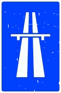
S-1
Motorway
The start of a motorway, and so the point from which that road type's special rules apply. It can also mark a slip road at an interchange leading onto a motorway.
Catalogue section 3.8
They give useful information about the road type and its special rules: motorway, tunnel, one-way, pedestrian zone.
How to recognise them: A square or rectangular sign with a blue background and a white symbol or wording.
These signs give information, and several of them mark where a different set of rules begins. S-1 marks the start of a motorway and, with it, of that road type's special traffic rules; S-1a does the same for an autovía, S-1b for a multi-lane road and S-1c for a 2+1 road, with three lanes and two-way traffic, whose middle lane is for overtaking and is reserved for each direction in turn. Each has its end sign in the S-2 series.
The same start-and-end pairing runs through the rest of the group: the road reserved for motor vehicles (S-3 and S-4), recommended speed (S-7 to S-10), home zones and pedestrian zones (S-28 to S-31a), ways for cycles and personal mobility vehicles (S-35 to S-44) and the shared-space zone (S-47 and S-48). Among the others are recommendations, such as S-7, which advises you not to exceed a speed; the position of a pedestrian crossing (S-13) or of a footbridge or subway (S-14a to S-14f); and places to stop: parking (S-17 and S-17a), taxis (S-18), buses (S-19), trams (S-20), lay-bys (S-34) and emergency escape lanes (S-16).
Signs in this group that look alike, and what separates them according to their definitions.
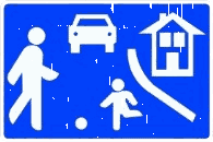 S-28
S-28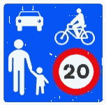 S-47
S-47Both are areas meant first of all for pedestrians, who have priority and may use the whole of the traffic area. In S-28 the speed limit is 10 km/h and games and sport are allowed; in S-47 it is 20 km/h and they are not.
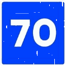 S-7
S-7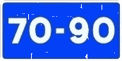 S-9
S-9S-7 advises you not to exceed one speed; S-9 to stay between two values. Both are advice for when weather, road and traffic conditions are good, and under a danger sign they cover the stretch where the danger lasts.
 S-11
S-11 S-12a
S-12aS-11 and its variants say that a carriageway of one, two or three lanes is one-way in the direction of their arrows. S-12a and S-12b say the same of a section of carriageway.
 S-22
S-22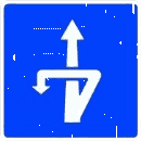 S-25
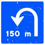
S-25Both announce a place to turn round. At S-22 you turn at the same level; S-25 announces an exit through which you turn round at a different level.
 S-15a
S-15a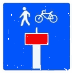 S-15e
S-15eOn every S-15 sign, the dead-end road is the one drawn inside a red box. S-15e adds an exception: it is a dead end except for pedestrians or cycles, whose pictograms it carries.
70 signs
S-1
The start of a motorway, and so the point from which that road type's special rules apply. It can also mark a slip road at an interchange leading onto a motorway.
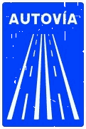
S-1a
The start of an autovía, and so the point from which that road type's special rules apply. It can also mark a slip road at an interchange leading onto one.
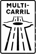
S-1b
The start of a multi-lane road, and so the point from which that road type's special rules apply. It can also mark a slip road at an interchange leading onto one.
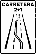
S-1c
The start of a 2+1 road: one with three lanes that carries traffic in both directions. The middle lane is there to make overtaking easier and is reserved for each direction in turn. It can also mark a slip road at an interchange leading onto a 2+1 road.
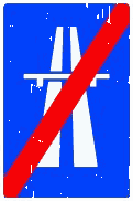
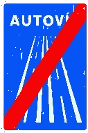
S-2
The end of a motorway.
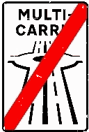
S-2a
The end of an autovía.
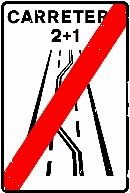
S-2b
The end of a multi-lane road.
S-2c
The end of a 2+1 road.
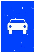
S-3
The start of a road reserved for automobiles.
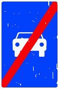
S-4
The end of a road reserved for automobiles.
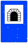
S-5
The start, and possibly the name, of a tunnel, underpass or stretch treated as a tunnel. Its length in metres may appear underneath.
S-7
A recommended speed in km/h that it is best not to exceed, even in good weather and traffic conditions. Placed under a danger-warning sign, the advice covers the stretch where that hazard lasts.
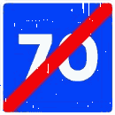
S-8
The end of a stretch where the speed shown was recommended.
S-9
Recommends keeping your speed between the values shown, as long as weather, road and traffic conditions are good. Placed under a danger-warning sign, the advice covers the stretch where that hazard lasts.

S-10
From here, the earlier recommended-speed-range sign stops applying.
S-11
On the single-lane carriageway continuing in the arrow's direction, drive the way the arrow points; traffic the other way is prohibited.

S-11a
On the two-lane carriageway continuing in the arrows' direction, drive the way they point; traffic the other way is prohibited.
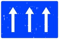
S-11b
On the three-lane carriageway continuing in the arrows' direction, drive the way they point; traffic the other way is prohibited. With more lanes, the number of arrows matches them.
S-12a
On the section of carriageway continuing in the arrow's direction, drive the way the arrow points; traffic the other way is prohibited.

S-12b
On the section of carriageway continuing in the arrow's direction, drive the way the arrow points; traffic the other way is prohibited.
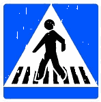
S-13
Marks where a pedestrian crossing is.
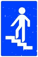
S-14a
Marks where a pedestrian footbridge is.
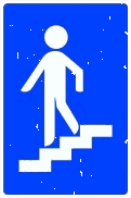
S-14b
Marks where a pedestrian subway is.
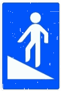
S-14c
Marks where a pedestrian footbridge fitted with a ramp is.
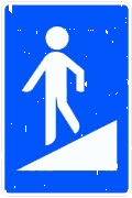
S-14d
Marks where a pedestrian subway fitted with a ramp is.
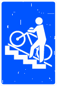
S-14e
Marks where a pedestrian footbridge fitted with a cycle rail or ramp is.
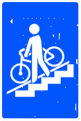
S-14f
Marks where a pedestrian subway fitted with a cycle rail or ramp is.
S-15a
The road shown boxed in red on the sign is a dead end.
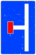
S-15b
The road shown boxed in red on the sign is a dead end. A mirrored version may be used to match the actual layout.
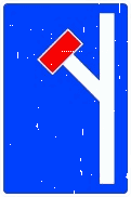
S-15c
The road shown boxed in red on the sign is a dead end. A mirrored version may be used to match the actual layout.
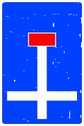
S-15d
The road shown boxed in red on the sign is a dead end.
S-15e
The road shown boxed in red is a dead end except for pedestrians or cycles. The sign carries the pictogram of whoever the exception covers.
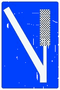
S-16
Marks an escape lane built so a vehicle can be stopped if its brakes fail.
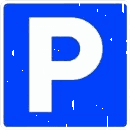
S-17
Parking is allowed here. Wording or a symbol for certain classes of vehicle means parking is reserved for them. Wording giving times limits how long you may park.
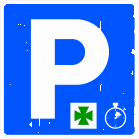
S-17a
Parking is allowed here only for one specific purpose — reaching a pharmacy, a hospital and so on, shown by the pictogram — and only for a set time, given on a supplementary panel.

S-18
A place reserved for available, on-duty taxis to stop and park. A number gives the total spaces reserved.
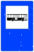
S-19
A space reserved for buses to stop.
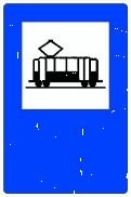
S-20
A space reserved for trams to stop.
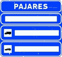
S-21
Shows whether the pass or stretch named at the top of the sign is passable.
S-22
A place is coming up where you can turn round at the same level.
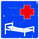
S-23
Marks a hospital, and reminds you to take the care that being near medical premises calls for — above all, not making noise.

S-24
The end of a stretch where at least dipped headlights were compulsory. You may switch them off, unless visibility, the time of day or the road's lighting still require them.
S-25
An exit is coming up through which you can turn round at a different level.

S-26a
On a motorway or dual carriageway, the next exit is roughly 300 m away. Where the exit is on the left, the diagonal runs down from left to right and the sign stands on the left of the carriageway.

S-26b
On a motorway or dual carriageway, the next exit is roughly 200 m away. Where the exit is on the left, the diagonal runs down from left to right and the sign stands on the left of the carriageway.

S-26c
On a motorway or dual carriageway, the next exit is roughly 100 m away. Where the exit is on the left, the diagonal runs down from left to right and the sign stands on the left of the carriageway.
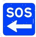
S-27
Marks the nearest SOS post or first-aid post from which you can call for help after a crash or a breakdown. The sign may give the distance to it.
S-28
An area meant first of all for pedestrians, where special rules apply: vehicles are limited to 10 km/h and drivers must give way to pedestrians; vehicles may park only in places marked by signs or road markings; cycles and, where applicable, personal mobility vehicles may travel in both directions unless the competent authority decides otherwise; pedestrians may use the whole area, so pedestrian crossings are not marked; games and sports are allowed there. It always comes with an R-301 sign limiting speed to 10 km/h.
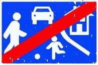
S-29
The general traffic rules apply again.
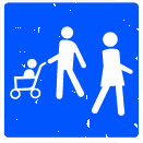
S-30a
An area reserved for pedestrian use.
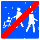
S-31a
The end of an area reserved for pedestrian use.

S-32
A vehicle using the lanes marked this way may pay the toll by dynamic or electronic tolling, as well as by other means, provided it carries the equipment for it.
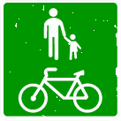
S-33
A way for pedestrians, cycles and, where applicable, personal mobility vehicles, separated from motor traffic and usually running through open ground, parks, gardens or woodland, though outside built-up areas it may also run alongside the road. When people are walking on it, cycles and, where applicable, personal mobility vehicles must slow down so that everyone stays safe and can share the way. Pedestrians, likewise, must let cycles and, where applicable, personal mobility vehicles pass.

S-34
Marks a place where you can pull over in an emergency to leave the way clear.

S-34a
Marks a place in a tunnel where you can pull over in an emergency to leave the way clear, fitted with an emergency phone.
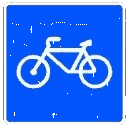
S-35
A way meant for cycles; all other road users are barred from it.
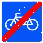
S-36
The end of a way meant for cycles.
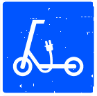
S-37
A way meant for personal mobility vehicles; all other road users are barred from it.
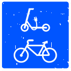
S-38
A way meant for cycles and personal mobility vehicles; all other road users are barred from it.
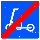
S-39
The end of a way meant for personal mobility vehicles, from which other road users were barred.
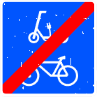
S-40
The end of a way meant for cycles and personal mobility vehicles, from which other road users were barred.
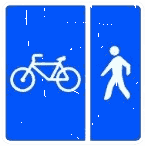
S-41
A way for cycles and pedestrians with separate space for each. The sign's layout may be adapted to how the spaces actually run.
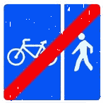
S-42
The end of a way for cycles and pedestrians with separate space for each. The sign's layout may be adapted to how the spaces actually run.
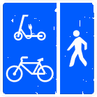
S-43
A way for cycles, personal mobility vehicles and pedestrians, with the first two separated from pedestrians. The sign's layout may be adapted to how the spaces actually run.
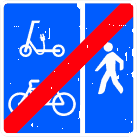
S-44
The end of a way for cycles, personal mobility vehicles and pedestrians, with the first two separated from pedestrians. The sign's layout may be adapted to how the spaces actually run.
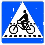
S-45
Marks where a cycle crossing is.
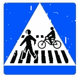
S-46
Marks where a pedestrian crossing alongside or shared with a cycle crossing is.
S-47
An area meant first of all for pedestrians, where special rules apply: vehicles are limited to 20 km/h; the space is shared between vehicles, cyclists and pedestrians; pedestrians have priority and may use the whole area, so pedestrian crossings are not marked; cycles and, where applicable, personal mobility vehicles may travel in both directions unless the competent authority decides otherwise; vehicles may park only in places marked by signs or road markings; games and sports are not allowed.
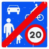
S-48
The general traffic rules apply again.
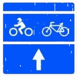
S-49
A waiting area before the stop line at a light-controlled junction, reserved for the vehicles shown on the sign — motorcycles, three-wheelers treated as motorcycles and mopeds (all three shown by the motorcycle pictogram), or cycles.
The definitions in the list follow the regulation's Spanish text. The introduction and the comparisons are ours.
Source: Reglamento General de Circulación — Anexo I, apartado 5: Catálogo oficial de señales de la circulación y marcas viales (Catálogo de señales verticales, tomo I) · Anexo I, apartado 5 (Catálogo de señales verticales de circulación, tomo I)
Keep going
Get the app
Everything above lives in the app for iPhone and Android. Free to start — no card needed.
Spanish driving theory, in your language
Available for iOS 15+ and Android 8+.